
How Greenbrier Property Search Works
For most Greenbrier properties, the smartest first step is the Assessor's search. Carry its parcel ID into every later record. An address works well when the road name is known. An owner search can surface trusts, companies, multiple parcels, or several people sharing a name. Once a result is identified, the parcel ID is the most exact cross-reference available. The state WV Assessment form lets you choose county and district, then search by full parcel ID, owner, map, street name, parcel, or sub-parcel. Greenbrier's Assessor page also links the county Interactive Tax Map. Treat the result as a route, not the last word.
- Enter the street address, owner or parcel detail in WV Assessment Property Search.
- Open the matching parcel and note owner, district/map/parcel, legal description and deed book/page.
- Compare the same identifier in the County Clerk’s Online Deed Inquiry; search names as grantor and grantee.
- Check the mapped location in the WV Property Viewer and use the tax portal for the tax ticket.
- Ask the custodian for the recorded deed or counter lookup when the online trail is incomplete.
Greenbrier's search fields do not promise a match in every format. A rural route, a former street name, or an unusual owner spelling may return nothing. Try a parcel segment or the legal description instead.
Greenbrier Assessor Search Fields
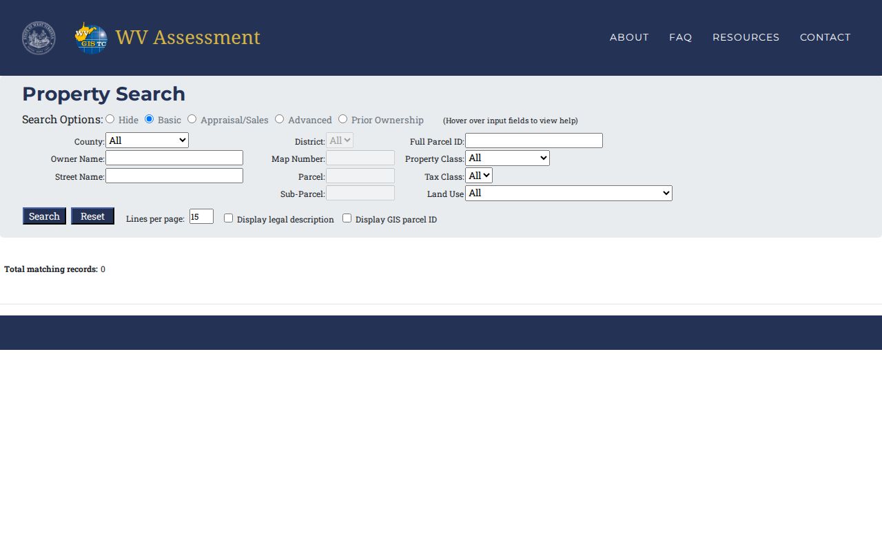
The assessment page pairs simple fields with deeper filters. Start with the basic county, district, parcel, and owner entries. When a name or street returns a long list, the advanced controls narrow it down. The table reflects the labels and field types on the live statewide portal; where no exact-match rule or dropdown options are published, those limits are stated rather than guessed. The full form is available through West Virginia Assessment. The screenshot below shows the entry form used for Greenbrier County.
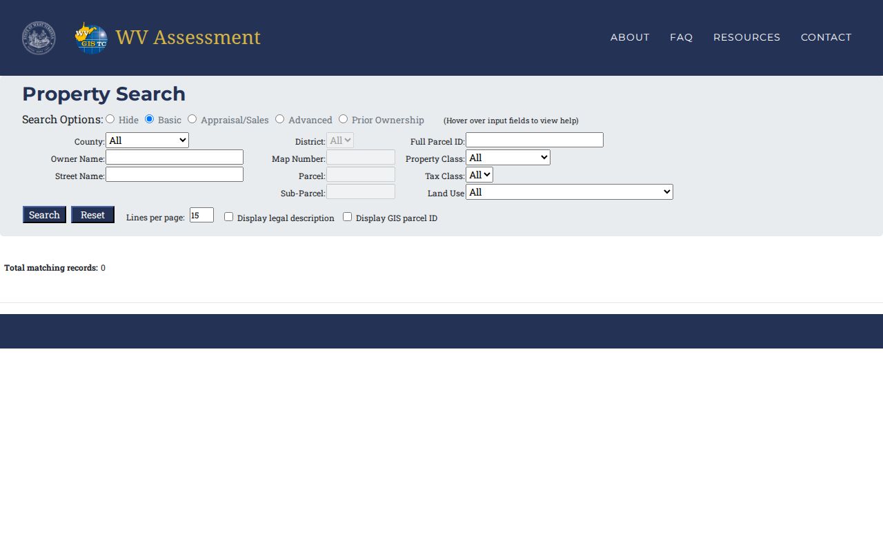
Start with a field you can verify. Add filters only when they sharpen the result set. A blank response may reflect spelling or format, not the absence of a Greenbrier record.
| Portal Field | Kind | What Greenbrier Search Uses It For |
|---|---|---|
| County and District | Selection | Set the Greenbrier search area and district. |
| Full Parcel ID | Text | Find a known tax parcel; use the displayed format. |
| Owner Name | Text | Search the name tied to the assessment roll; match behavior is unstated. |
| Map, Parcel, Sub-Parcel | Text | Enter parts of a parcel number when the full ID is not at hand. |
| Street Name | Text | Return parcels associated with a road name; partial-match behavior is unstated. |
| Property Class, Tax Class, Land Use | Dropdowns | Narrow by classification; options were not exposed in the captured text. |
| Min/Max Land Appr | Number range | Filter by appraised land value. |
| Min/Max Building Appr | Number range | Filter by appraised building value. |
| Min/Max Total Appr | Number range | Filter by total appraised value. |
| Calculated and Deeded Acres | Number ranges | Compare GIS-calculated and deed-stated acreage. |
| Sale From / Through and Price | Date and number | Limit Appraisal/Sales results by sale period or price. |
| Flood Hazard | Dropdown | Filter a hazard category; options were not exposed. |
| Mailing Address | Text | Search the address used for tax correspondence. |
| Deed Book and Page | Text | Find a parcel from its recorded deed reference. |
| Legal Description | Text | Search a description term or phrase. |
| Building Year, Structures, Area | Ranges | Filter by age, structure count or building area. |
| Display Legal Description / GIS Parcel ID | Checkboxes | Add the cross-reference fields to results. |
| Lines per Page | Number | Set the result display size. |
Greenbrier Street Name Search
Street Name is useful when the target address is unclear but the road is known. In Greenbrier it can produce a block-wide starting list. The street number, district, and parcel number then help separate nearby lots. The portal does not document whether street matching is exact or partial. So try the base road name and a shorter version if the first query comes back empty. Not every row is an adjacent lot. A single road can span several communities, and a street search may return properties far apart.
When comparing entries, keep the situs or physical address apart from the owner's mailing address. The mailing address can be a post-office box. It can also be an agent's address, or a residence outside the parcel's community. The GIS viewer can reconcile a candidate against roads and parcel lines. The recorded plat or deed describes the legal lot. Use a Street Name result to find candidates. Then check each candidate's actual parcel ID.
What a Greenbrier Parcel Card Shows
A selected Greenbrier parcel returns a useful cluster of identifiers and facts. The screens do not all show the same detail. The WV Property Viewer identifies an owner, a physical or E-911 address, legal-description area, building information, cost and appraised values, community, and delinquent status. The Assessor describes selected-parcel fields including neighborhood and deed book and page. It also lists separate land, building, and total appraised values. One owner may appear in the viewer even when several people own the parcel. The sample assessor result sits on the same county-filtered page used for live lookup. It shows how a parcel result ties a tax value to the Clerk's book-and-page reference. Open the Greenbrier assessor result page to select a parcel. The card below is a sample view.
Read the legal description and deed reference alongside the name. Those fields reduce confusion when an owner holds several parcels or a recent transfer has not yet reached the roll.
| Property Owner | The owner field shown for the selected parcel; multiple owners may not all display. |
|---|---|
| Physical / E-911 Address | The location assigned to the parcel or improvement. |
| Mailing Address | Where tax correspondence is directed, which may differ from situs. |
| Parcel ID | The assessment/GIS key; use the exact district, map, parcel and suffix. |
| Legal Description | Lot/block or metes-and-bounds detail from the record context. |
| Appraised Values | Land, building and total amounts from the assessment record. |
| Deed Book / Page | A cross-reference for locating the recorded instrument. |
| Building Information | Property characteristics; the interface has a separate detail area. |
| Delinquent Status | A tax-status clue requiring confirmation with the Sheriff/Tax Office. |
The card is an assessment record. It is not a market appraisal or a complete title report. A last-sale date or consideration field does not appear in the sample parcel card. Look for the deed and ask the Clerk. Do not assume the roll shows a final sale price.
Read the Greenbrier IAS Parcel Number
West Virginia parcel numbers share one structure. District, map, parcel, and suffix segments fit together like a filing code. The viewer's example looks like 2-0011-0001-0000, with leading zeroes kept in place. The portal displays its own sample too. Greenbrier district prefixes and ranges are not published. So copy the identifier straight from the Assessor result rather than constructing one from a street or town name.
The parcel ID is an administrative key. It is not the deed's legal description. Splits, merges, and re-parceling can generate a fresh number while the deed keeps the older lot, acreage, and boundary language. When a search lands on a neighbor or a near-miss number, compare district, map, and suffix along with the situs address. One exact number reconciles a viewer, a tax roll, and a permit form faster than anything else. It anchors most Greenbrier property searches.
Keep the whole ID. Greenbrier searches use the displayed parcel number as shown, including district, map, parcel and suffix segments. Do not guess a missing segment from a nearby parcel.
Greenbrier Appraisal and Prior Ownership Modes
WV Assessment exposes Basic, Appraisal/Sales, Advanced and Prior Ownership modes. The form supports value and acreage ranges, sale dates and prices, building year, structure counts and building area. Those filters can help distinguish a parcel when a common name returns many rows or when a researcher has an approximate sale period. The accessible source does not state how many prior owners are included, the age of the data or the exact sale-price field shown on each result.
A result produced by a sales filter should be treated as a pointer to the underlying instrument, not as a verified closing statement. A recorded deed can identify the grantor, grantee, legal description and recording location, while the state form’s indexed sale information may summarize those details. Greenbrier’s assessor applies annual values as of July 1, so the tax roll and an instrument recorded later can represent different points in time.
Use Deed Book and Page
Greenbrier results often include a deed book and page. Pair both numbers for the County Clerk. The assessment record never replaces the deed image itself. Run the named grantee and grantor through the Clerk's Online Deed Inquiry, then match the recording date and legal description against the assessment entry. Follow the earlier deed reference when the chain matters. If the instrument stays hidden online, the Clerk's four public computer stations and older book indexes are the fallback.
The index cutoff year is not stated. Image availability and result caps are left unstated too, so field labels may vary. A missing result means try another spelling, a counter search, or an archive request. It does not mean the transfer never happened. Greenbrier deed records cover the chain and the document-copy trail.
Separate Situs and Mailing Address
Greenbrier parcel results separate two addresses. The situs marks where the land or building sits. The mailing address tells the tax office where to send correspondence. That field may hold a post-office box, an agent, a lender, or a second residence. The split matters here. Rural roads and town postal names do not always follow municipal lines in this county.
New construction has an extra step. The County requires a physical address from Emergency Management before issuing a certificate of occupancy. A listing's mailing city proves nothing about city limits. Confirm the tract on the county map, and check Planning & Permits or the municipality when zoning hangs on jurisdiction. USPS confirms format, not ownership or boundaries.
Greenbrier Permits Use Parcel Keys
Greenbrier's paper permit form runs on parcel keys. It asks for tax district, tax map, parcel, lot, and a physical 911 address. Owner, applicant, mailing address, contractor, utility, and construction details fill out the rest. Applicants who owned the parcel under two years must list the previous property owner. That makes the application a possible property-history lead. Whether permit files are publicly searchable goes unstated.
Cloudpermit handles online applications, inspection status, scheduling, canceling, time-stamped messages, card or e-check payments, and edits. Paper remains an option. Rural parcels may also have septic or well files with the Environmental Health Department; call 304-645-1539 about those office-held records. A permit field is a lead, not a deed.
Find Greenbrier Parcels Without an Address
A search can start without any street address. The WV Property Viewer searches parcel attributes, geometry, or coordinates. A parcel number works whole or in pieces. Geometry search takes a buffer size and a unit selector. Coordinates can locate a tract with no road name. Copy Link and Download KMZ controls preserve the map view or save a map file for later.
The buffer tool is documented, but it may not return a tidy neighbor list. Select and identify parcels one by one instead. The map layers include roads, parcels, aerial images, hydrography, soils, and flood data. Those lines orient a search. They do not settle a legal boundary. See Greenbrier parcel maps for the GIS layers and survey limits.
Choose a Greenbrier Search Key
Pick the key that matches what you already know about the land. An address points to one likely situs fast. A name works better when a person holds several parcels. A parcel number is the most precise match of all. Greenbrier County supports all three. The Clerk's deed search leans on party names and legal descriptions rather than a modern street address.
| Search Key | Best For | Where It Works | Watch Out |
|---|---|---|---|
| Address | A known house, road or E-911 location | Assessor and WV Property Viewer | Mailing address and situs can differ. |
| Owner name | A person or entity linked to land | WV Assessment; Clerk party index | Try spelling variants; a viewer may show one owner. |
| Parcel ID | An exact tax/GIS parcel reference | Assessment, GIS and permit records | Keep every district/map/parcel/suffix segment. |
Not a title search. A Greenbrier search shows indexed facts and public instruments, not a guarantee that every interest, lien or later conveyance has been found. For a transaction, have the title reviewed by a qualified professional.